I’m not even going to try to recall how many times I made Elyse cross the street…
8 minute read
October 31, 2017, 2:30 PM
Here’s some “new old stock” for you. Back in March 2016, I had the idea of writing about a fatal pedestrian accident that happened in December 2015 at the intersection of Veirs Mill Road (MD 586) and the Matthew Henson Trail in Rockville. It was an area that I was very familiar with, as one of the routes that I did on the bus went through this area. I did the field work for that planned Journal entry, photographing the area in question, as well as a few other pedestrian control devices in Montgomery County, in order to have a discussion similar to the one I did in March 2013 about an intersection on Georgia Avenue. Unfortunately, however, life got in the way, as I got a promotion at work, and the several-months-long training program that came with that promotion took precedence over the planned Journal entry. The post eventually got shelved, and now it’s a moot point, as the intersection was initially upgraded with yellow warning signals directly over the crossing (vs. 500 feet ahead of it as before), and then after a second fatal accident in the same location, the crossing was upgraded again with signals that actually require traffic to stop vs. only warning drivers of the presence of pedestrians.
I was always a bit disappointed that an entire afternoon’s work never got used. Like the Breezewood photo shoot in 2006, evidence of the shoot showed up fairly soon after the work was done – in this case, a single photo feature – but the intended final product never got made. In hindsight, I’m not too worried about it, because what I would have advocated for in the intended Journal entry came to pass, though I wish that it hadn’t happened as a result of a second fatal accident.
The shoot itself was pretty fun. I brought Elyse with me, and we made a good team. The way we did it was that I set the camera up on my tripod and pointed it at whatever I needed, started filming, and then signaled to Elyse to activate the signal. She then crossed the street, in order to give some legitimacy to the signal activation. After all, I knew that I was stopping traffic on some fairly busy roads for a photo shoot. I had Elyse cross the street so that I didn’t look like a complete dick, stopping traffic for no reason. Someone needed to cross the street, so that it didn’t look like I was stopping traffic just to film the signals. I imagine that Elyse probably did about a mile going back and forth across several intersections in Montgomery County and DC. After all, every single take (and I did multiple takes) required activating a signal, and that meant sending Elyse across the street.
We started as far out as we would go, and then worked our way inward, photographing different signals along the way. The first signal that we photographed was a variant on a HAWK beacon on East Gude Drive in Rockville, near Fisher Lumber:
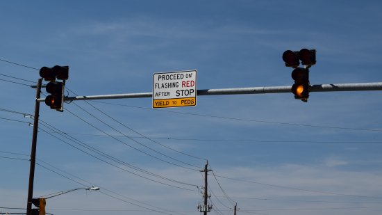
Two signals on a mast arm over East Gude Drive.
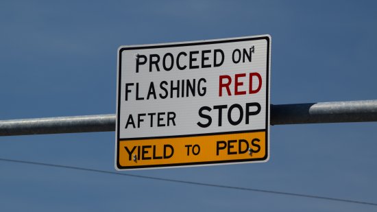
Directions on how this signal functions. Basically, solid double red meant stop, flashing double red meant stop, look, and then proceed.
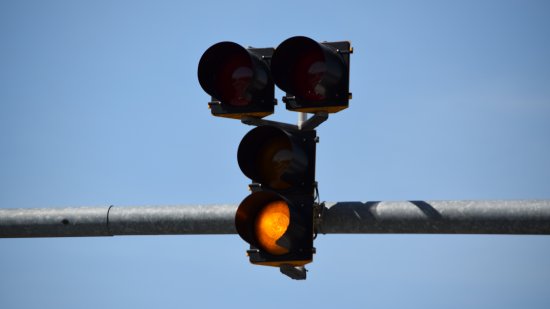
Flashing yellow light on the bottom. This signal functioned more or less like a HAWK beacon, but unlike a true HAWK beacon, which goes completely dark when not activated, this signal has a flashing yellow light when it’s not active.
And here it is in action, i.e. I sent Elyse across the street for this:
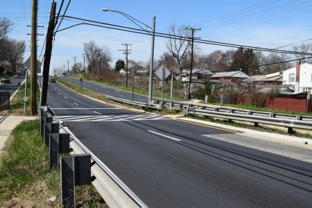
After we finished up at East Gude Drive, we went to the subject intersection, i.e. Veirs Mill Road and the Matthew Henson Trail. There, I filmed the warning lights as they existed at that time, and documented the intersection from all sorts of angles.
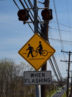
The warning lights approaching the crossing for eastbound traffic. I am embarrassed to say that before this intersection got some media attention, I didn’t even realize that these lights existed, because no one ever used them.
The lights in action:
These lights ran for about 45 seconds as soon as the button was pressed. One problem here was that with the signals’ being 500 feet upstream from the crossing, it took eight seconds for the first vehicle that saw the illuminated warning lights to reach your destination, assuming that they’re going the 45 mph speed limit (and we know that everyone follows the speed limit). Drivers in the first eight seconds after pressing the button never saw any sort of warning about pedestrians and bikes crossing, because they were already past the sign when the lights started flashing.
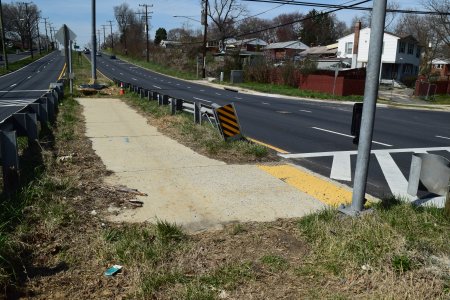
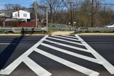
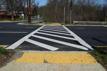
The crosswalks for the two sides of this crossing are offset, and this section of sidewalk in the median connects the two. As I understand it, it’s laid out this way to prevent cyclists from running both sides in a single motion.
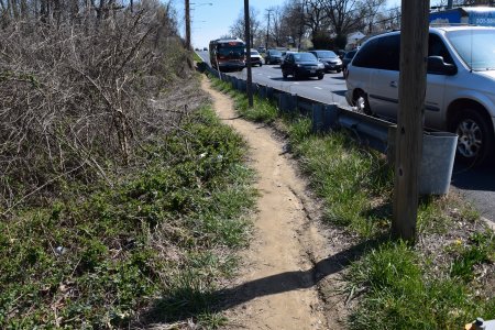
Well-worn desire path along the side of westbound Veirs Mill Road. There are no sidewalks in this area, and this path runs from Havard Street all the way to the subject crossing at the bottom of the hill.
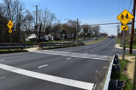
Westbound crossing. Note the stop line and warning signs.
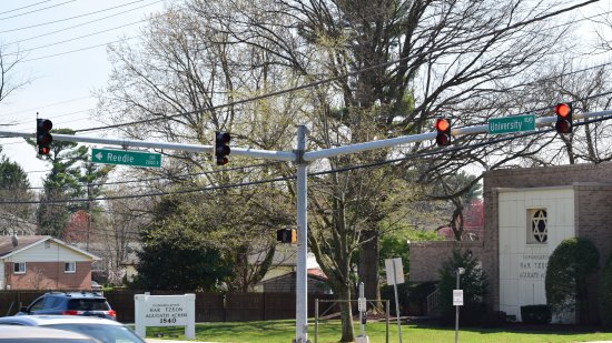
We then headed over to University Blvd (MD 193) and Reedie Drive in Wheaton. That location had another HAWK variant, though this one covered both roads with different signals. The intersection doesn’t see much cross traffic for cars, so a standard traffic signal is unnecessary, but University Blvd is one of those roads where angels fear to tread, because it’s wide and fairly busy.
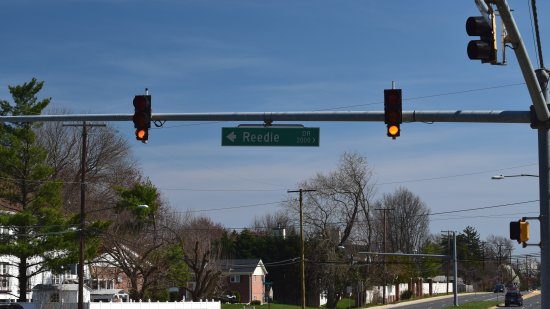
Signals facing traffic on eastbound University Blvd, where traffic normally does not have to stop. The signal functions similarly to the signal on East Gude, where the bottom light flashes continuously when the signal is not activated, it flashes quickly when it’s activated, and then goes yellow to red, stopping traffic. However, unlike East Gude, there is no flashing red light. When the cycle is over, it goes right back to bottom yellow flashing.
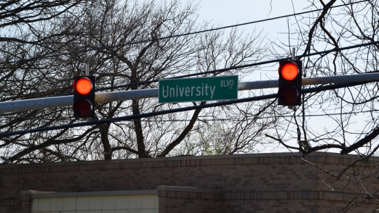
Signal for traffic on Reedie Drive. Along with this signal, traffic on Reedie Drive also has a stop sign. The pattern is top flashing red when the signal is not activated, then both red lights flash when the signal is activated, and then solid red on both lights, after which the signal resets.
And here’s video of the signals in action:
University Blvd signal.
Reedie Drive signal.
Both sides together.
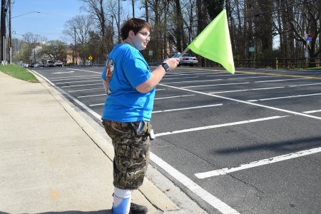
We then headed over to East-West Highway (MD 410) at Summit Hills Apartments, which is a flag crossing next to a well-used bus stop. There, pedestrians are supposed to grab a flag and carry it with them across the street, and place it in a holder on the other side of the street. There were no written instructions on how to do this anywhere that I could find.
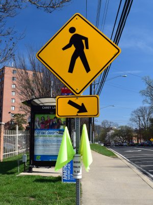
Warning sign with a cup containing some yellow flags.
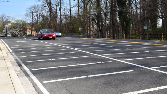
Approach to the crossing for westbound traffic. Lots of lines on the road in approach to the crosswalk.
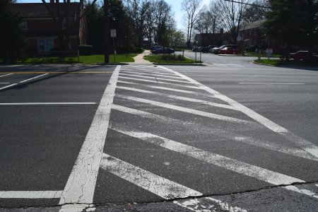
The crossing itself. Note no median or pedestrian refuge island. That meant that you had to do all four lanes at once, with no signals or warning lights, with a 35 mph speed limit for traffic.
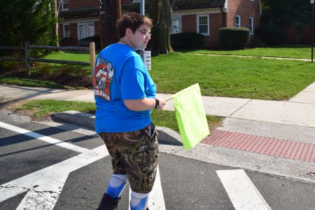
Elyse demonstrates the use of the crossing flag.
I’m not going to lie to you: out of all of the crossings that we did, this one made me the most nervous. Traffic is moving relatively quickly, and there’s a lot of it. It also doesn’t help that traffic is moving uphill in approach to this crossing in both directions, and there are curves on either side. It really was a matter of grabbing the flag, looking both ways, and then praying that you don’t get run over while you’re crossing.
DC used to have a similar flag crossing on Connecticut Avenue NW at the intersection with Northampton Street, but that was upgraded to a HAWK beacon a few years ago, i.e. traffic is now required to come to a full stop when the signal is activated via call button. Montgomery County should consider doing the same here, and be proactive about it, i.e. doing it before there is a fatal accident. However, I do wonder how well it would work at this location, considering that there is a fully signalized intersection approximately 650 feet east. Considering the volume that this road does at certain times of day, I wonder if a full stop here during busy periods would cause it to spill into the nearby intersection. Who knows.
Then the last signal that Elyse and I documented was a true HAWK beacon in DC, at the intersection of 16th and Jonquil Streets NW. This one was a challenge to film because unlike the others, which are activated via call button, this one was sensor-activated, and it’s harder to make a sensor go off than it is to just press a button (I didn’t realize that this was sensor-activated until we got there).
The pattern was standard for HAWK beacons, i.e. fully dark when not activated, flashing yellow warning when it’s about to change, solid yellow just like a traffic light, and then double red while pedestrians have a walk signal. When the pedestrian signal changes to the flashing hand and starts counting down, the lights flash in a wig-wag pattern. Then the beacon goes dark again when the don’t walk sign is solid.
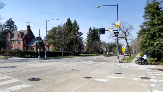
Overview of the intersection. The HAWK beacon governs traffic on 16th Street NW. Jonquil Street traffic has a stop sign.
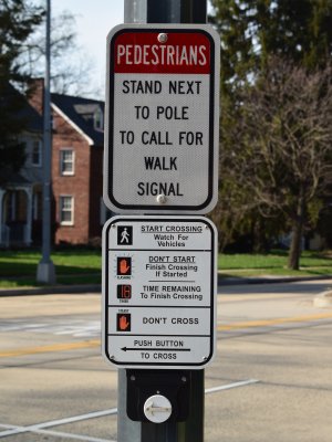
Sign directing pedestrians to stand next to the pole to activate the sensor. The call button is apparently obsolete, as it didn’t do anything when I pressed it.
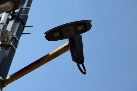
The sensor, mounted to the pole that the HAWK beacon is on.
So there you have it. Even though I never used the material for its intended purpose, hopefully someone finds this material useful.
Categories: Elyse, Roads, Rockville, Silver Spring, Washington DC, Wheaton


A few things here:
1. IIRC, the incidents on the Matthew Henson Trail at Viers Mill happened within about a week of each other. As with the Braeburn Parkway intersection on River Road, implementing an obvious solution resulted in foot dragging because SHA was involved and was going strictly off its engineering guidelines, indicating that both intersections were up to standard. I think they did a good job with the Viers Mill crossing, but the River Road solution is poor and I think it would have been better (and safer) just to close off that intersection to all left turns and cross traffic once and for all.
2. The process for activating the signal at 16th and Jonquil is unique because the crossing is used primarily by people walking to and from the two synagogues on that block of 16th Street (one on each side of the street). Since people won’t use the call button on the Sabbath or festivals, there needs to be a different way to activate the signal. In my experience, the button *does* work, while I don’t think I’ve had as much luck with the stand by the pole method. But in addition to those options, on Saturdays and on holidays (including those that don’t fall on Saturday), the HAWK activates on its own on a regular basis, just like any other traffic light. You can see it do this on Friday evenings and much of Saturday, and it did so frequently during the week throughout the holidays in September and October. (The next non-Saturday holidays are the second day of Passover which falls on a Sunday and the seventh day of Passover which falls on a Friday.) While not a HAWK, the lights at the intersection of Arcola and Lamberton have an all pedestrian phase on Saturdays (and possibly on festivals and other days of the week, I haven’t been up that way during Shabbat or on a holiday in many, many years) so that people can cross Arcola safely without using the call button.
3. Pretty sure a light at Summit Hills is infeasible due to the distance to the next light in either direction. Not only is that a difficult place to cross (I prefer crossing at 16th), it is also very difficult to pull out of Summit Hills and turn on to East-West because of the speed of traffic and the hills.