Back on November 6, Elyse and I took the drone out for a spin again, and I did some photography. This time, we went out to Leesburg, and took a late afternoon golden-hour flight around a familiar landmark: the former Walmart off of Route 15. This is a typical 1990s-era pylon-style store, and it closed in May 2019 when a new Supercenter opened elsewhere in the Leesburg area. Because of the proximity of the location to Leesburg airport, I had to notify the airport of our activity using their online form, and then, whirlybirds away. I flew up and around the building, and even investigated the roof a little bit.
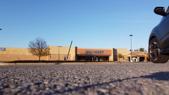
A pre-flight capture, with the HR-V at right.
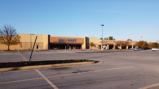
Shortly after taking off, at very low altitude.
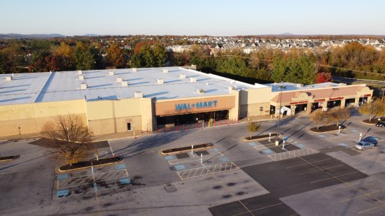
Way up in the air, about halfway down the parking lot, southwest of the entrance.
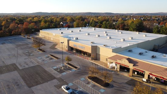
View from the southeast, from a similar distance away.
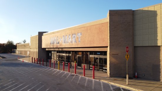
Here, I was flying at approximately the beltline of the building, i.e. where the stripe is located (painted out in this instance). I took a similar shot from the ground in February.
Up above the store, to the southeast.
Higher up, more or less directly in front of the entrance.
A little lower and further back to the southwest.
The sign area, between the two pylons, photographed dead-on. I took a similar photo from the ground in February, but the results weren’t as pleasing.
The same angle, having moved straight back past the parking lot islands. Again, I got a similar photo from the ground before, but this one is more pleasing because it’s higher.
Side view from the west. The garden center is just behind the camera to the left.
Then I investigated the roof a little bit.
Flying over the roof. I’m going to estimate that we’re over where the women’s clothing department would have been when this was still Walmart.
Air handling unit on the roof, approximately over the service desk.
This thing on the roof, near the air handling unit. Your guess is as good as mine as to what this is.
After investigating the roof, I went up, ultimately going up to the maximum allowed height of 400 feet.
Complete view of the Walmart building, from the southeast.
The Walmart building and other shops, viewed from the maximum altitude of 400 feet.
View facing north, angling the camera straight out from the previous shot. Northbound Route 15 is in the right of the photo, and if my reckoning based on Google Maps is correct, the mountains in the distance are in the Harpers Ferry area (but feel free to correct me if I’m wrong).
Another view at max altitude, from slightly further back.
The last thing that I did before landing was to photograph one of the parking lot lights. I chose this one in particular because the cover was hanging down.
And back on the ground, next to the HR-V. Before landing, however, I used my real camera to take a photo of the drone in flight.
So there you have it. I like photographing here, mainly because it’s an older Walmart building, but with no chance for some Walmart manager to come out and bother me for photographing the store without prior authorization from corporate.
Meanwhile, who knows how long this store is going to stay in this state. Last I heard, Floor & Decor, which has other locations in the area, was considering a location in this space. However, this was back in normal times, just before pandemic fever came into full swing, and I haven’t heard anything else since. So I figure that they either are quietly working their way through the planning process, or have abandoned the idea. Who knows.