An overnight trip to Pennsylvania…
14 minute read
August 21, 2024, 10:21 AM
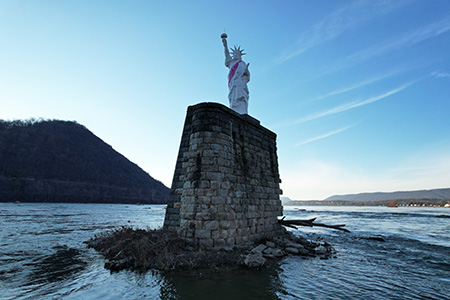
On August 15 and 16, I made an overnight trip to Pennsylvania. The main purpose of the trip was to photograph some things in the Harrisburg area, and also make some stops in Gettysburg, York, and Hanover. Nowhere that I went was new territory for me, and I got everything that I wanted. This was one of those trips where I started out with one idea, and then built a trip around it to justify it. That idea was to fly my drone around a replica of the Statue of Liberty that someone erected in the middle of the Susquehanna River just north of Harrisburg. I had previously flown a drone around this same subject on the afternoon of January 5, and quickly realized something: the lighting was wrong for what I wanted. The statue faced approximately east, and coming in late afternoon, the sun was behind me, which didn’t lend itself to good photography. My photography technique was fine, but the lighting was wrong. See for yourself:
Yep… the lighting just wasn’t there, with the sun directly illuminating the back side of the statue rather than the front, which made for shots that I didn’t like and probably won’t use for anything. A shame, but those are the breaks sometimes.
However, I did get some usable material from that day, from an unplanned stop afterwards at the Walmart in Swatara Township, i.e. the one with the lopsided facade. That produced this photo feature of the sunset. I liked it, but it definitely wasn’t what I had come out there to do. At the end of the day, the final result was that I had driven for two hours and 100 miles for some pretty photos of the sunset, which I could have done in MoCo.
So in planning this trip, I knew one thing: I had to get to the statue in the morning. That meant running it as an overnight trip, because I wasn’t too keen on getting up super early and battling morning rush hour traffic, either in Frederick or Harrisburg. I figure, I could get the hotel room for free with credit card points, so I couldn’t think of a good reason not to do it as an overnighter. Get up to Harrisburg the night before, get a good night’s sleep, then wake up and get started. This was a pretty lopsided itinerary, too, as all of the important stuff was on the second day. All I had on the agenda for the first day was to get up there, and then I gradually worked my way south on the second day, meeting all of my photography goals.
First on the itinerary was Gettysburg. That was never really intended to be a big thing, and it wasn’t. It is roughly midway between home and Harrisburg, and it made for a good spot to take a break. I parked on Steinwehr Avenue and walked along a few blocks just to see what was open that wasn’t a restaurant. I ultimately ended up visiting a few gift shops, none of which were anything to write home about. They all sold the typical crap that you would see at a souvenir shop. You got your shirts that say “Gettysburg” on them, some flags from both sides, some Civil War-themed hats, various jewelry items that have nothing to do with anything, some arts and crafts items, some ghost tour items, and, surprisingly, Trump merchandise. Some managed to come off as a little bit classier than others, but for the most part, they all sold the exact same stuff. Very tourist-trappy, for sure. Next time I do a walk in Gettysburg, I will probably go further up, closer to the town square. It was fun, though, even if it did get repetitive rather quickly. Surprisingly, I took no photos in Gettysburg, but in all fairness, the opportunity never really presented itself.
Finishing up in Gettysburg, I continued my journey north to Harrisburg. It was a pretty uneventful ride up, and I made it to my hotel, a Residence Inn just north of the city, in the 10:00 hour. I brought my stuff in, did a quick Sheetz run for dinner, and that was my night.
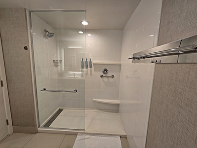
The next day, the first thing that I did was take a shower. Take a look at this setup:
Two things struck me as somewhat bizarre. First, the controls for the shower are in the back corner, on the opposite side from the showerhead. I’ve seen that once before, but it’s still weird. The second and more notable thing is that while this is a walk-in shower, there is no way to fully enclose it. There is a fixed glass partition on the showerhead side, and no door. This had a few different effects. First, without a way to enclose the shower space, it left me feeling a bit exposed, even though I was traveling alone (Elyse was away on a different adventure). Additionally, because it was all open, it did a terrible job in keeping the heat in the shower, as air convection in this rather large bathroom caused a lot of drafts, even with the door closed, making me cold, despite the hot water. Just what I want in a shower is a cold tush. Would a smaller bathroom have helped mitigate this? I don’t know, but I’ll bet that a door on the shower would have made a whole lot of difference. And then from a practical standpoint, there was nothing preventing water from coming out of the shower and getting on the floor. It was just an overall poor design, and it would probably make me think twice about staying here again. The other Residence Inn, where Elyse and I stayed in March 2020, had a more conventional shower design.
After I finished with the shower, I got packed and checked out of the hotel, and navigated back to where I had parked back in January. I got everything unfolded, and then, whirlybirds away. This time, the light was a lot more favorable, and the photos looked like I wanted them to:
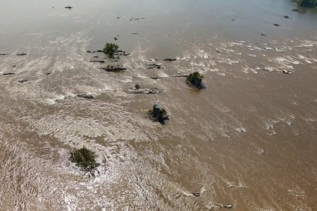
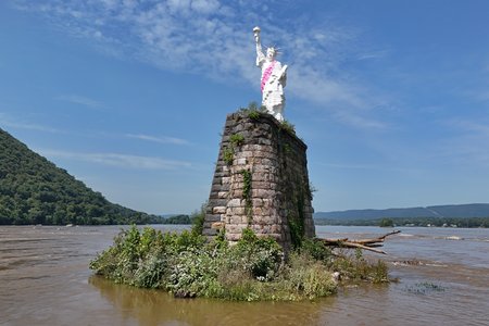
Coming up on the statue at my cruising altitude of 393 feet. The statue is in the center of the photo, on a pier that once held a railroad bridge.
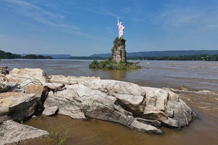
Down near the water level, from a distance.
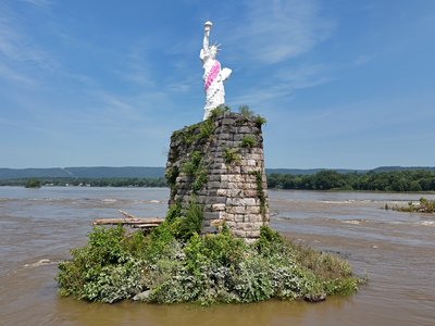
A closer-in view of the statue, showing the full pedestal.
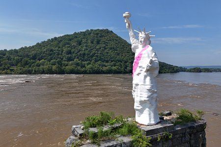
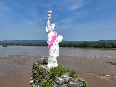
At eye level with the statue. The pink stripe dates from work done a few years ago, when the statue got a pink paint job a few years ago for breast cancer awareness. The nails on her left hand were also pink, which you’ll see further down, and I assume that those were done at that time as well.
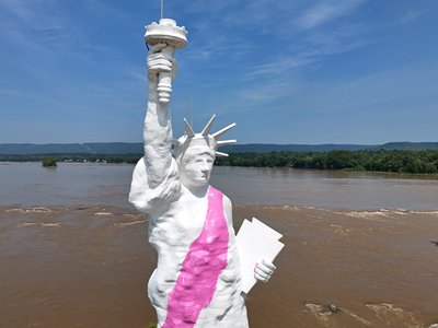
Close up view of the statue. I find it interesting how much detail there is in some areas of the statue, and how little there is in others. The details on the body make her look like she has cellulite, and the face is not very detailed, but the crown, tablet (which is a bit more Pennsylvania-shaped than the real one), and torch (with no flame) are very sharp. Though in all fairness, the statue was never intended to be viewed at this close of range. Most see it from a distance of 1,300-1,600 feet, and then only for a moment.
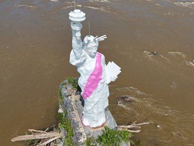
Overhead view. Note the lightning rods on both the statue’s head and the torch.
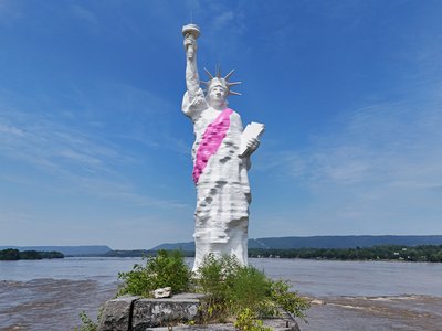
I guess that this is your “iconic” view of the statue. But there she is, facing east in the middle of the Susquehanna.
I have more photos of the statue, but I’ll save those for when I get to them in the queue for benschumin.com (i.e. my new portfolio site).
Before I left the area, I also got some other photos, mostly of roads and rails:
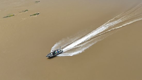
On the way out to my first rail target, I spotted and photographed a powerboat going down the river.
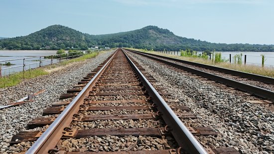
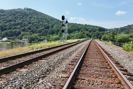
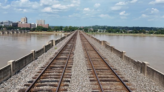
The Rockville Bridge, facing west (top) and east (bottom).
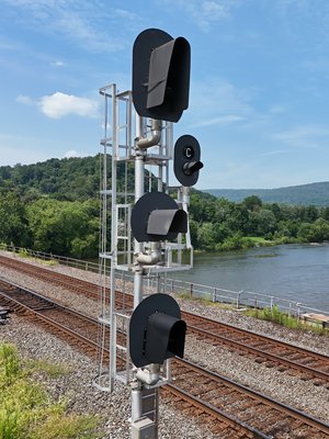
Darth Vader-style signals on the Rockville Bridge.
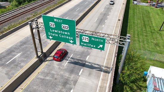
Overhead signage on US 22.
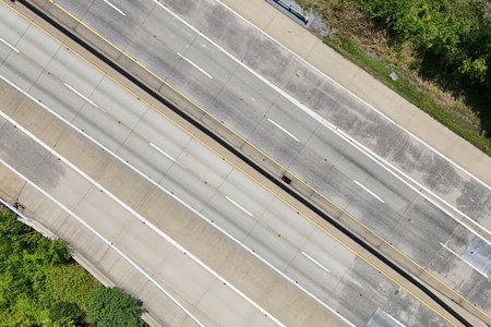
US 22 from above, in a moment when my frame was clear of cars.
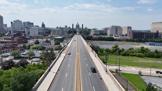
From there, I packed the drone up, set a few batteries on the charger, and laid in a course for my next destination. This was a park and ride lot at the corner of State and North 13th Streets. When Elyse and I went up to Harrisburg in November 2021, which produced the Three Mile Island photo set, we also did a few other things. We went to a closing Sears store at the Colonial Park Mall, we found a Sharp Shopper store in Middletown, and I walked the State Street Bridge with my DSLR and my tripod with an eye towards getting some night shots of the Pennsylvania State Capitol. I only got one halfway decent photo from the bridge outing, which was disappointing when you consider how much time and effort that I had put into it. File that idea under things that were better in theory than in practice, I suppose. One thing that made the outing so disappointing was the presence of two large pylons on the western end of the bridge. They seemed to get in the way of what I wanted, and were a constant source of frustration.
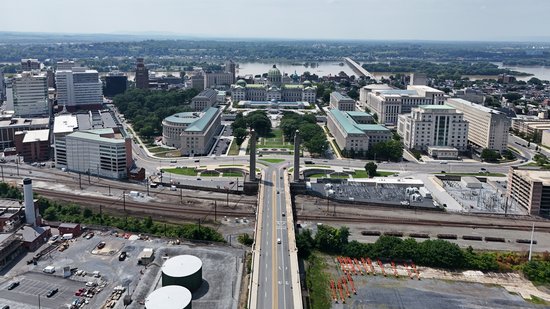
So the thought this time was that I would fly the drone, and get above those pesky pylons. That was a bit problematic as well, because even when flying above the pylons, their presence is constant. Plus the view from above is not nearly as majestic as the view from the ground, because the ground view doesn’t show the properties that surround the bridge. What the State Street Bridge goes over is a low-lying strip of land that is used for industrial purposes, and it’s not exactly pretty. The sun also didn’t favor this angle, and I suspect that I would need to do another overnight trip to Harrisburg in order to get favorable light this way. That wouldn’t be the worst thing ever, though.
All of that said, here’s some of what I got:
Yeah, those pylons were very hard to deemphasize. Plus the afternoon light did me no favors. I did better when I curved around the south side of the property to get some other angles:
I did a bit better when I went a little further around. The angles were better, and the light was better, too. Only problem was that I ran into range issues when I got around that last shot, so if I wanted to explore further, I needed to reposition to the other side. I ended up going to the 100 block of Locust Street, between Front and River Streets, and flew from there. The strategy was that I was far enough away that someone would have to go to some effort to find me in order to bother me (i.e. leave me alone while I’m flying), but close enough that I could still see what I needed to be able to see, plus have good signal.
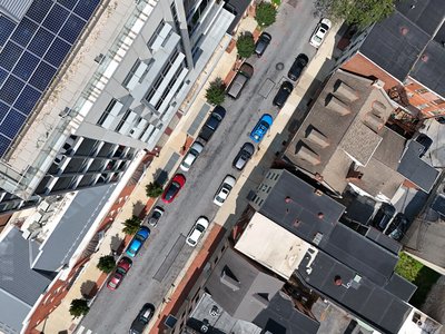
Overhead view of Locust Street just after launching. My car is approximately in the center of the shot.
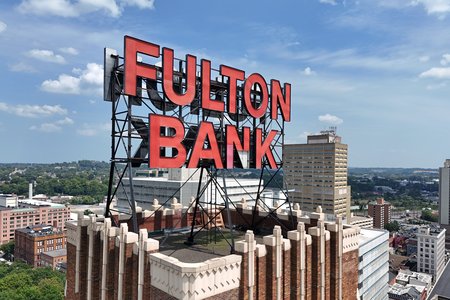
“Fulton Bank” sign on a nearby building. The lighting on this was perfect, but unfortunately, part of the “N” in “BANK” was damaged. (If this looks familiar, I’ve photographed it before.)
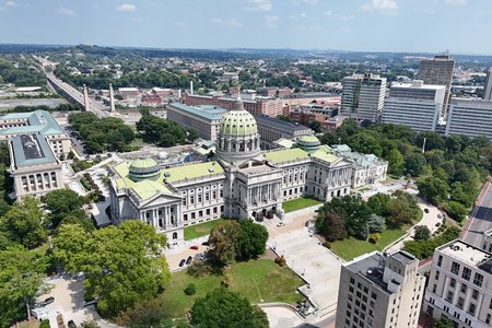
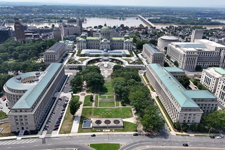
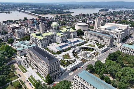
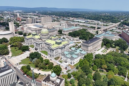
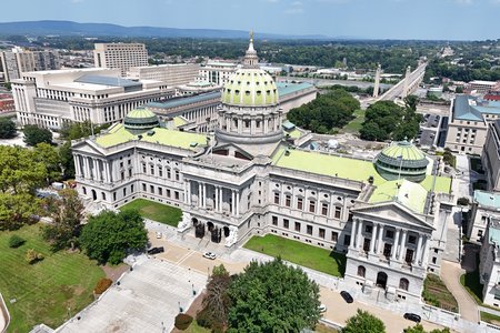
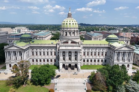
Then this is what aerial imagery of the Pennsylvania State Capitol ought to look like.
I then repositioned again to be a little bit closer to the river, and did a flight over there. I had previously photographed this area in 2016, and was looking forward to photographing it again, this time by drone.
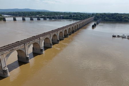
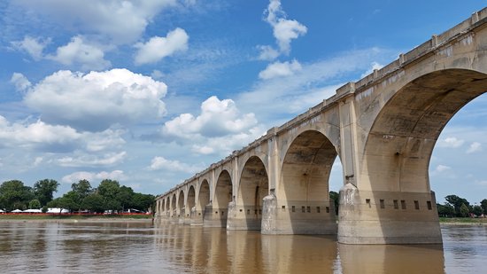
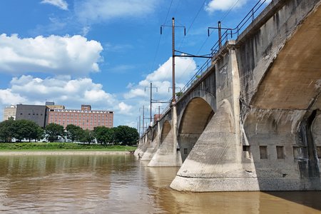
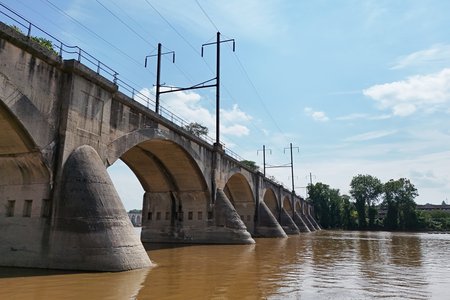
First, the Philadelphia & Reading Railroad Bridge:
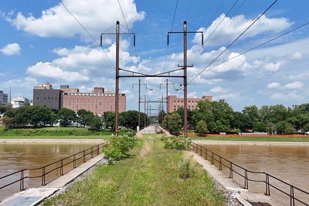
Then I checked out the Cumberland Valley Railroad Bridge, which is a disused railroad bridge just upstream:
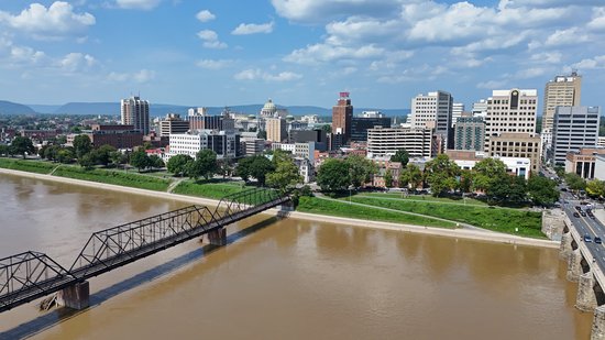
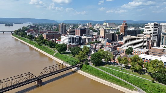
I then shot a few images showing the skyline with the river, but I’m not sure how much I like the angles:
I suppose that the images worked well enough, but admittedly, these skyline shots were something of an afterthought, as the low photos of the bridges were the priority here. I should probably do some more detailed planning if I’m going to try this again.
That was it for Harrisburg. It was just after 3:00 by now, and so I needed to start making my way back home, plus I had other goals to fulfill on the way back. One of my goals was to visit the Sharp Shopper store in Middletown for a few odds and ends, so I did that. On the way, I spotted a couple of vanity plates:
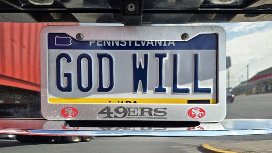
“GOD WILL”. And they’re a 49ers fan, apparently.
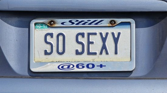
This one was clever, the way that they made the license plate and the frame go together.
Then at Sharp Shopper, I spotted this sign on a pallet of packages of “sparkling” Jell-O:
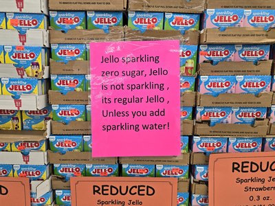
I don’t know about you, but if the product is marketed as “sparkling” like this, the thing that makes it sparkling should be built into the product, and not “sparkling if you add sparkling water to it”. The thought is that if this is just regular Jell-O, then I could do this at home with any gelatin product, and probably find a more interesting flavor than these. I posted this in a sign group that I’m in on Facebook, and people that recognized the location indicated that they’ve been trying to move this product for quite a while. I completely understand why, because the idea seems like kind of a loser.
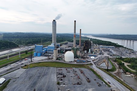
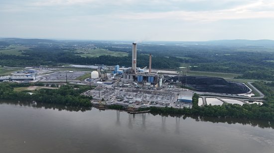
From Sharp Shopper, I went over to my final planned photo target for the day: Brunner Island Steam Electric Station. I have photographed this location before, and did fairly well at that time. I wanted to take the drone for a spin around it and get some aerials, so I did. The trick here was determining a flying location. I had mixed thoughts about this one. On one hand, when Elyse and I photographed here in 2016, we were pretty open about things shooting with our DSLRs, and nobody bothered us. But this time, I was using a drone, and people too often wet their pants when they see a drone buzzing around an area and then start bothering the pilot. So part of me wanted to fly right in front of everything based on past experience, and part of me wanted to hide my location out of an abundance of caution. The cautious side of me ended up winning, as I found a small parking area on Gut Road, just south of the plant, to use as a base. I also really got the car dirty there, as Gut Road is gravel, and very dusty. The road was also fairly well traveled for a gravel road, and so cars going by would kick up even more dust that would land on my car. In other words, add “Get the car washed” to the list of goals for this day.
So here’s what I got at Brunner Island:
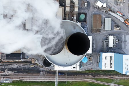
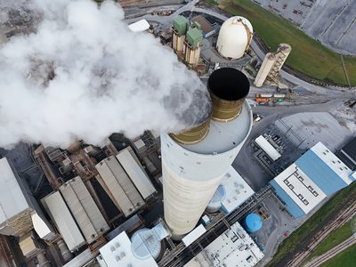
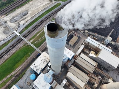
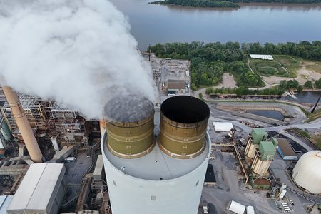
Top-down view of the smokestack. This was about as close as I got to the smokestack, because I didn’t want to inadvertently interact with that exhaust. I didn’t know how hot it was, and I didn’t want to find out.
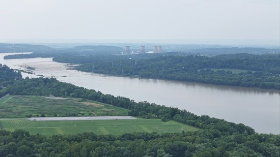
View of Three Mile Island from Brunner Island. I never realized that the two power plants were so close to each other. Turns out that they are a little more than four miles apart.
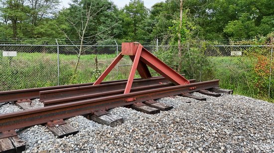
Bump post at the end of one of the railroad tracks at Brunner Island. Yes, my foamerism knows no bounds.
I also shot a few videos at Brunner Island, focusing on the smokestack:
All in all, I got decent photos at Brunner Island, but not great photos. It was starting to get into the evening by the time I got to Brunner Island, plus it was starting to cloud up. This is another instance where, if I wanted to reshoot this, it would probably be prudent to run it as an overnight trip.
And that was the end of the drone for this adventure. Its work was done, so I stowed it for the rest of the trip. My next stop was in York, where I explored around downtown a bit via car, scouting out a potential future photo set. I was looking for lighted signs, and determined that there was enough interesting signage in downtown York that I could probably make a photo set out of it, similar to what I did in Ocean City back in 2021. When that will happen, I don’t know, but it’s in the queue.
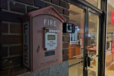
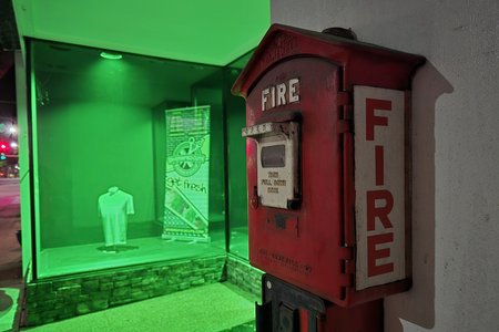
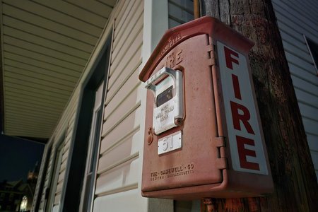
From there, I headed down to Hanover. There, I wandered a few blocks around the main town square on foot, with only my phone to photograph with. I was surprised to find Gamewell boxes in Hanover, but here they are:
I looked it up when I got home, and found out that Hanover really does have a citywide municipal fire alarm telegraph system, and also found a nice little article about it. I wrote the fire department to inquire about getting a list of the locations of all of the boxes. Hopefully I hear back from them, because that could be a fun photo shoot to do in the future.
And that was the trip. From there, I stopped at a car wash on PA 94 to blow all of the dust from earlier off of the car, and then headed home via Westminster. Clearly, I had fun on this trip, because I fell asleep pretty quickly after I got home and brought all of my stuff in.
Categories: Fire alarms, Gettysburg, Hanover, Harrisburg, Photography, Travel, York



Leave a Reply