When the bridge is gone…
6 minute read
January 3, 2025, 5:21 PM
On December 27, Elyse, Aaron Stone, and I went on a little outing that included a stop at Fort Armistead Park in Baltimore, which is located adjacent to the Key Bridge. This bridge was destroyed in the early morning of March 26, 2024 in a shipping accident that was captured live on camera, where the MV Dali collided with a support pier. Following evidence collection for an investigation into the accident, the debris was removed and the shipping channel was reopened.
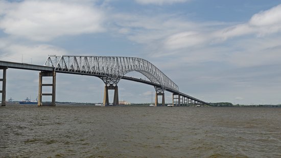
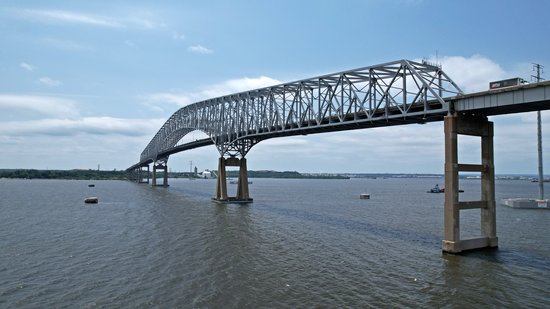
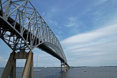
I had first visited Fort Armistead back in 2022 on a previous outing with Elyse and Aaron, which is a popular location to photograph ship traffic going in and out of the Port of Baltimore, and got a few shots of the Key Bridge at that time:
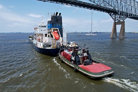
Ships would go underneath this bridge to enter and exit the Port of Baltimore. as seen here:
Things looked a bit different this time around. The bridge was gone, with only a few piers remaining to mark the bridge’s former alignment. It was kind of surreal, with the bridge’s being missing and the nearby highway’s being very quiet due to its link across the Patapsco River’s being severed. Even driving over to Fort Armistead felt odd, with signage covered or changed both on I-695 and on nearby roads, and with concrete barriers’ directing all traffic off of 695 via exit 1, dumping travelers onto Quarantine Road, and ultimately onto Route 173.
Getting up in the air again, here’s what I saw:
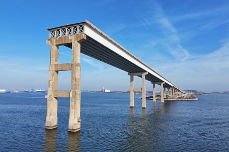
The Sollers Point (northeast) approach to the bridge, ending abruptly. This section ends three piers out over the water, with an entire section held up by three piers missing before reaching the truss section. I could account for two piers from that missing section, but not the third.
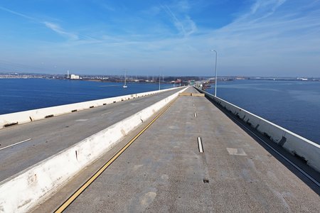
A now-silent highway, facing the counterclockwise direction. It felt very weird to be able to get these kinds of shots, considering that with the bridge intact, this area would be full of vehicle traffic, and thus my drone would have no business being this close.
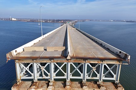
This sort of angle really emphasizes the abrupt end of the roadway, as the bridge is simply missing.
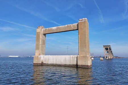
This was the fifth pier in the water on the Sollers Point side of the bridge. This pier is cut off after the first cross-beam, and was three times this height prior to the collapse. The remains of the fourth pier are visible in the distance as two stubs. I did not locate the sixth pier, which is where the truss section began, but I may have simply missed it.
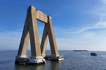
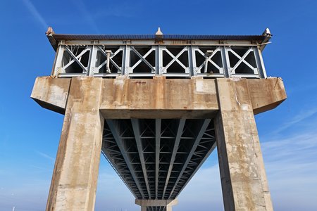
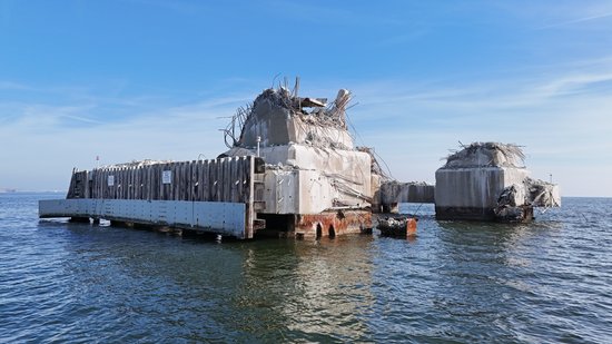
One of two triangular piers, this one more to the northeast, which held up the truss section of the bridge. This pier was not struck by the Dali, and acted as something of a pivot point as the bridge gave way.
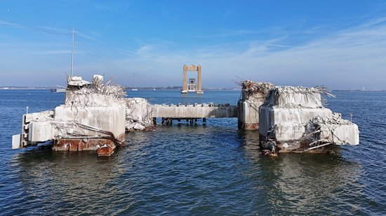
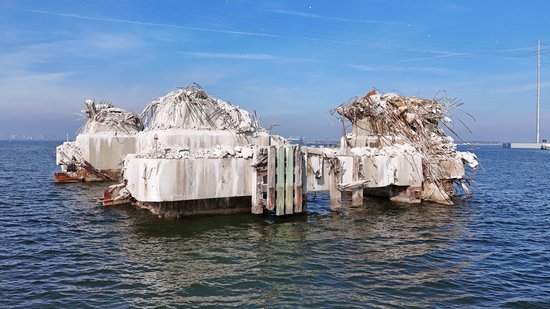
This is the pier that was struck by the Dali, identical to the triangular pier above. The pier was sheared off close to the waterline, and based on the bridge’s design as a continuous truss structure, there was no way that it would have been able to remain standing with such a critical pier missing.
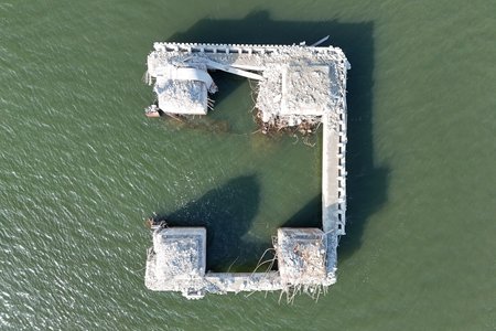
Overhead view of the struck pier. The Sollers point section is to the right in this shot.
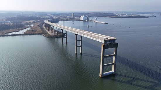
The Hawkins Point (southwestern) section of what remains of the bridge. The truss section would have started on that third pier over the water.
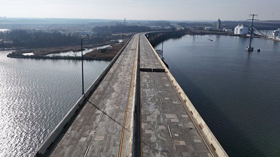
Another silent roadway on the Hawkins Point side of the bridge. The freeway is closed for the entire distance that is visible here.
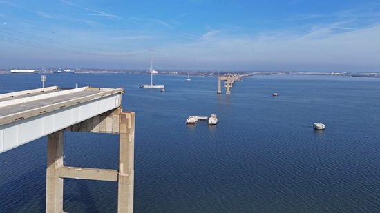
The area where the truss section once stood, viewed from the Hawkins Point side. Compare to this similar view from 2022.
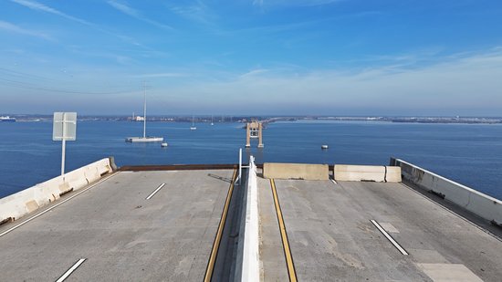
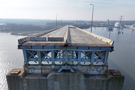
The edge of the roadway from the Hawkins Point side, facing the other side.
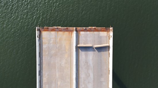
The edge of the roadway on the Hawkins Point side, looking straight down.
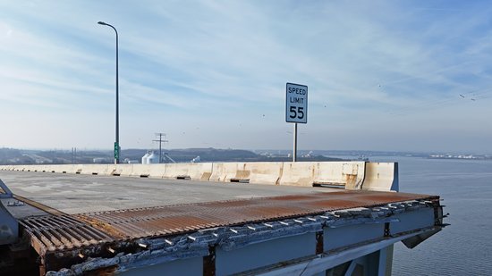
Seeing a sign indicating a speed limit of 55 adjacent to the end of the roadway was an eerie reminder that what we were seeing was not normal nor planned. My first thought upon seeing the sign still mounted there was, “55? Yeah, good luck with that.”
While I was over there, I also planned to photograph some ship traffic, just like I did in 2022. However, while I was out there, I saw very little ship movement. I suspect that it might have been because of the date (this was the week between Christmas and New Year’s), so I wasn’t too concerned. All I saw was this little guy:
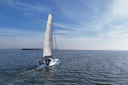
The Blue Wave, a Pogo 44 sailboat.
That homeport of Apex, North Carolina listed on her stern caught my interest, so I looked it up. Turns out that Apex is very far inland, roughly 120-130 miles from the Pamlico Sound. Why Apex was chosen as the homeport is puzzling to me, but who knows – maybe that’s where the owner lives, but the boat itself will never go there.
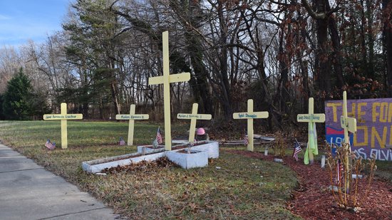
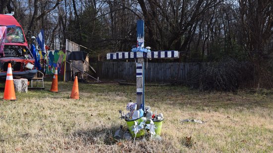
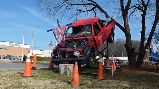
Then on the way out, we photographed a makeshift memorial for the highway workers who were lost in the collapse, near the intersection of Fort Armistead Road and Route 173:
This memorial really drove home the point that this collapse was more than just a mechanical failure, because six highway workers lost their lives when the bridge that they were working on collapsed underneath them. I certainly hope that a permanent memorial is placed somewhere as part of the new bridge’s construction, but at the same time, I also can’t imagine any scenario where a memorial to those killed in the collapse would not be included in the finished project.
Meanwhile, demolition of the remaining pieces of the bridge is expected to occur over the winter and spring. Once that’s clear, we’ll all get to watch together as a new bridge takes form. Kiewit Infrastructure won the design-build contract for the work, so the only question now is what kind of bridge the replacement will be. My gut feeling is that the new bridge will be a cable-stayed design, similar to the Ravenel Bridge in Charleston. That bridge replaced a pair of cantilever truss bridges at roughly the same location. A cable-stayed bridge would certainly present a bold, new look for Baltimore, though I will miss the smooth curved lines of the old bridge.
I imagine that I’ll be back here a few times during the demolition to get progress photos. I also want to get more shipping photos, because those are always fun to do and Fort Armistead is a very accessible place for ship spotting. Stay tuned, I suppose.
Categories: Baltimore, Baltimore County, Roads, Ships



Leave a Reply