Midwest Road Trip
Part 8
November 9 was the eighth and final day of our road trip across the Midwest. At the end of this day, we would be back home. The day started out well enough. We all got up, and we got the Hampton Inn breakfast. Afterwards, I got the car loaded up and we were ready to go.
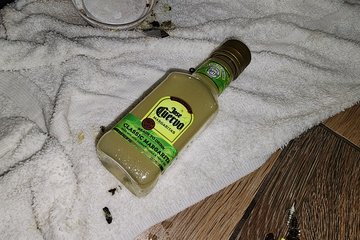
There was a technician servicing the ice machine that morning, and to everyone’s surprise, he found a full, still-sealed bottle of Jose Cuervo ready-made margarita stuffed in there somewhere. Makes you wonder what was going on there. Either way, free booze is still free booze, so I imagine that tech lucked out there.
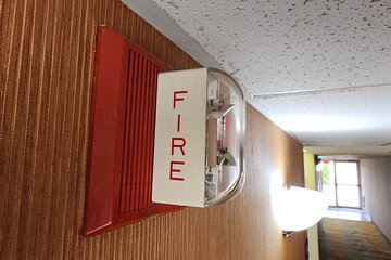
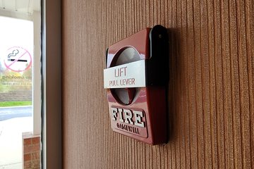
The fire alarm system was Gamewell, with Gamewell Century (“full moon”) dual action pull stations, and Wheelock MT notification appliances with a “Gamewell” sticker over the Wheelock branding. It’s uncommon to find a Gamewell Century in the wild to begin with, and even more uncommon to see the dual action variant.
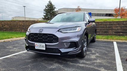
The HR-V, meanwhile, was ready to begin the final leg of our journey.
Kyle ended up going out on his own via public transit, while Elyse and I left together in the car. I took Elyse to the Stephanie Tubbs Jones Transit Center in downtown Cleveland, and set her down there. With Elyse at a transportation facility, she would be good for a while, so I went off to do my own thing. Everyone was fine with that, because neither Elyse nor Kyle were particularly interested in the stuff that I would be doing. The way I figured, downtown Cleveland wasn’t going anywhere, and Cleveland is definitely interesting enough to go back to as its own standalone adventure in the future, but I questioned the likelihood that I would be there again with the car in the foreseeable future, as a weekend trip to Cleveland or something would likely involve a more public mode of transportation.
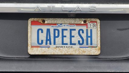
Soon after dropping Elyse off, I spotted this license plate that reads “CAPEESH”. I believe that the correct spelling is “capisce“, but the phonetic spelling amused me.
My first stop was the former City View Center, now Highland Park, in nearby Garfield Heights. That property is a former shopping center that has had a long, complicated history, but fortunately has come out with a happy ending.
For those not familiar, City View Center was constructed on top of a former landfill. When it opened in 2006, it contained a Walmart, Giant Eagle, Circuit City, PetSmart, Jo-Ann Fabrics, Dick’s Sporting Goods, Bed Bath & Beyond, OfficeMax, Fashion Bug, Payless Shoesource, and A.J. Wright. However, the shopping center began to fall on hard times when Walmart pulled out of the shopping center, citing structural and electrical concerns, as well as issues related to methane gas, all stemming from the facility’s being built on top of a former landfill. For what it’s worth, Giant Eagle subtly called them out for their closure, stating that their store has not experienced any of the issues that Walmart has cited, that government inspectors determined that the building and the shopping center were safe, and that their own methane gas detection system has not indicated any unsafe conditions. Following Walmart’s closure, the shopping center gradually died, as every other retailer, save for Giant Eagle, eventually closed their stores. In addition, a second wave of construction never occurred, which would have brought a Home Depot and a JCPenney store to the center, among other prospective tenants. The former shopping center remained vacant for most of the 2010s. There were plans during this time to do things with some of the buildings, including converting the former Walmart into a convention center, or using them to house various government facilities, but none of those plans came to fruition. In May 2019, the then-owner of the site, City View LLC, defaulted on its mortgage, and the property went into receivership. The mortgage was eventually acquired by Industrial Commercial Properties, LLC, and by the end of 2021, the property had been redeveloped, having been repositioned and remarketed for light industrial uses rather than retail. The new owners have apparently been at least somewhat successful with this new usage of the property, as industrial tenants now lease much of the former retail spaces. Meanwhile, the Giant Eagle store remains open, though it did close to the public in April 2020 to function as an online-only fulfillment center during the early stages of the COVID-19 pandemic, before reopening for regular shopping two months later.
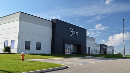
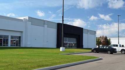
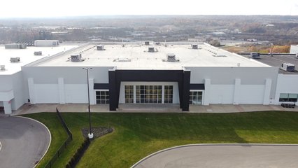
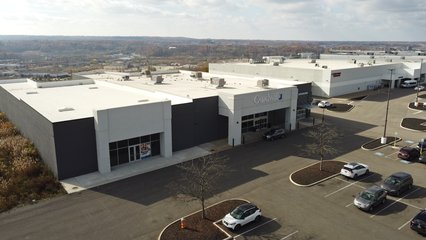
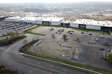
The former Walmart building at City View/Highland Park, now occupied by Mpac and Moxillo Transport.
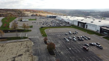
Looking down the center of the former City View Center. The parking lot has undergone some refurbishment, as the parking lot used to go all the way up to the buildings when it was used for retail, while there is now a wide strip of grass between the buildings and the parking lot. Also note that there are physical parking lot islands on one side of the lot, while the ones on the other side are simply painted on. Originally, there were matching physical islands on the other side of the lot, but when the parking lot was shortened in 2021, new islands were not built.
The rest of the former shopping center, facing approximately south. The grass strip that runs across the middle of the shot serves as a divider between the retail and industrial sections of the property.
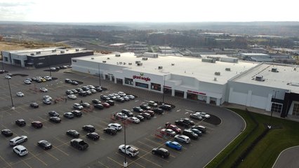
Looking down the center of the former City View Center, from just beyond the Giant Eagle building.
A vacant space which originally housed a Circuit City, and later was home to a Bottom Dollar store.
A row of smaller tenant spaces, still vacant.
EMX Industries, housed in the forrmer OfficeMax space.
Former Bed Bath & Beyond space, still vacant.
Former Jo-Ann space, still vacant as well.
Plastics manufacturer Innoplast, in the space that originally housed A.J. Wright, and later a Marshalls.
The last industrial building is the former Dick’s Sporting Goods, which remains vacant.
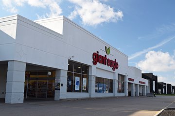
Giant Eagle, the only original retailer left in the shopping center. They have kept going throughout the center’s entire history.
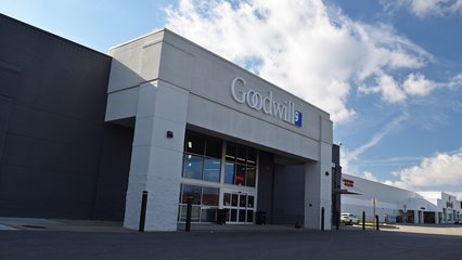
Former PetSmart building, now a Goodwill store. The vacant space to the left of the Goodwill, to my knowledge, has never housed a tenant, and was left half-constructed until the shopping center’s repositioning in 2021, when it was finally completed.
Part of the methane gas management system in the back of the Giant Eagle parking lot, protected by four bollards and four boulders. Such a system is part of what comes with its being built on top of a former landfill.
Another piece of infrastructure on the industrial side of the property. I suspect that this is methane-related as well.
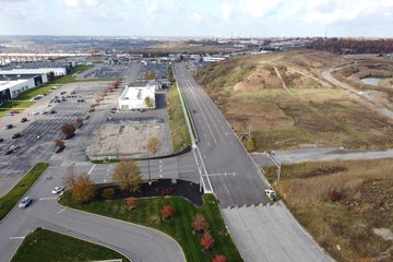
Transportation Boulevard, which is barricaded just beyond the entrance to the retail portion of the property. The road continues for about 500 feet beyond the barricade, but there is nothing to access beyond the barricade.
The area beyond the Goodwill building is graded for the second phase of the shopping center that was never built. This area was to have housed a Home Depot and a JCPenney, as well as several restaurants on pad sites. I imagine that this was cancelled when the shopping center started losing tenants in the portions that were already built, though I feel that unbuilt second phases are fairly common for 2000s-era shopping centers, as many other shopping centers’ second phases sere stymied by the 2008 recession.
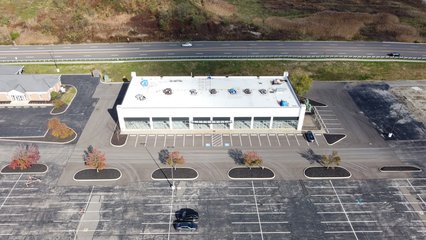
This appears to be the site of a never-built outparcel building of some sort, likely to house multiple small tenants.
Outparcel building designed to house multiple small tenants. This appears to have never been leased, based on the clean appearance of the building, as well as the lack of any partitions on the inside.
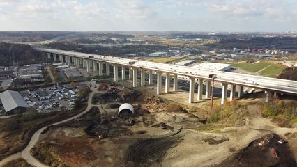
I-480 viaduct, which runs to the north of the shopping center.
Barricaded parking lot adjacent to an Applebee’s restaurant, intended to serve retail space that was never built.
Finishing up here, I filled up the car at a nearby GetGo (i.e. Giant Eagle) gas station, and then I was off to my next destination. That was Kent State University, a public research university in Kent, Ohio, to the northeast of Akron. Kent State was admittedly a bit out of the way for a day that was ostensibly about Cleveland, but I couldn’t figure out any other time that I would have the opportunity to go out there in the foreseeable future, so today was that day.
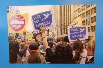
Most people probably know Kent State as the site of the Kent State shootings, where four students were killed and nine others were wounded when National Guard soldiers opened fire during a protest in opposition to the Vietnam War. The university later constructed a visitor center about the event inside Taylor Hall, a space that opened in 2013. As part of the construction of the visitor center, the university had contacted me in order to seek permission to use a photo that I had taken during Funk the War 3 in the new facility. My goal was to catch up with my photo and see its presentation in person, just like I had done at The Henry Ford.
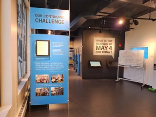
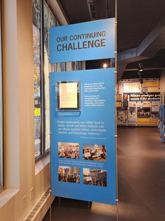
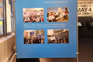
The visitor center’s exhibit was laid out quite well. It started out with a presentation about the state of the culture prior to the event, showing photos from antiwar events, as well as general photos from the period, as a way of setting the stage for the events that would come. Then they discussed the event itself. Finally, they discussed the aftermath of the event, and more recent antiwar movements. Looking through this section, I was starting to wonder if my photo had been left on the cutting room floor and hadn’t made it into the final exhibit, but then at the bottom of the very last panel at the end of the exhibit, there it was.
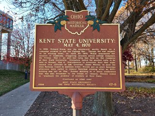
Historical marker memorializing the site of the shootings.
The first room of the exhibit.
The second room of the exhibit. My photo is visible in the bottom left.
The panel where my photo was located.
Selfie with my photo.
I also chatted it up with the students working there, who were fascinated by my being involved in the antiwar movement, plus the fact that I had come in to see my photo, as no one had previously seen a photographer whose work is featured in the exhibit come to visit. In a second room, which had some other exhibits in it, they had equipment for making buttons, as in to pin on clothing. I made three buttons. The first, I made following the printed directions, but was completely unsupervised. I soon discovered that I had inadvertently put some pieces in backwards, so the result of that was just a mangled mess of paper, metal, and plastic. After that, I got the attention of a student working in this room, and she helped me put the components in properly, and I made two buttons that were usable. The buttons say “I AM AN AGITATOR” and “STAMP OUT REALITY”, and those both now sit on my desk at home.
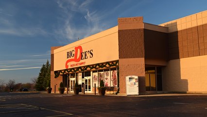
From there, I returned to my car, and headed back towards Cleveland. On the way back, I stopped to photograph Big Dee’s Tack & Vet Supply in Streetsboro. Big Dee’s, a horse supply store, was housed in a former pylon-style Walmart building, as Walmart had moved to a Supercenter about a mile up the road. Based on the new Walmart building’s architecture, this move occurred some time in the mid 2000s. According to Street View imagery, Big Dee’s opened in the space some time between September 2011 and October 2014.
Big Dee’s, housed in a former Walmart building.
Then I drove the rest of the way back into Cleveland. Elyse had Kyle had caught up with Clay, a friend of ours who lived in the Cleveland area, and he had taken them around the city a bit. I caught up with the three of them at Tower City Center. There, we checked out Cleveland’s RTA Rapid Transit system, i.e. their subway/metro system. We bought our tickets, and then we rode it two stops, from Tower City to East 55th Street and back.
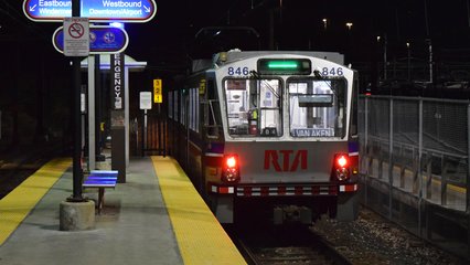
A Blue Line train at its western terminus at Tower City Center.
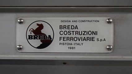
There’s a logo that I had not seen in quite a while. RTA’s LRVs were manufactured by Breda Costruzioni Ferroviarie, the same Breda that made the WMATA 2000, 3000, and 4000-Series railcars.
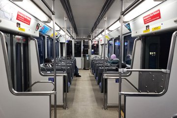
Interior of car 827A.
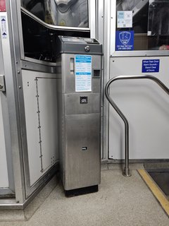
GFI farebox on car 827A. While we entered through fare control gates, presumably, not every station has this – thus the farebox.
Our Blue Line train departs East 55th Street.
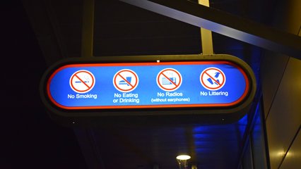
Rules sign at East 55th Street. The shape of the signage reminded me of the design language on the Baltimore Metro Subway.
“No smoking” sign that also encourages citizens to report violations. I have mixed feelings on this sign. No smoking? Cool. But don’t encourage people to snitch on others.
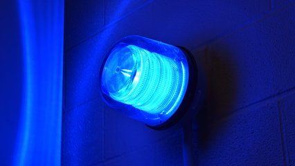
Blue light marking an emergency call box at East 55th Street.
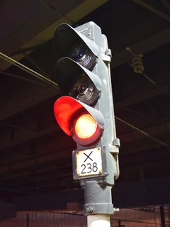
Three-aspect GRS/Alstom signal head at East 55th Street, displaying a red aspect. I have no idea how Cleveland RTA’s signaling system works, but I would love to find out.
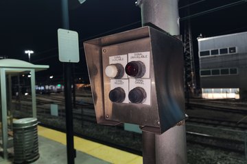
Route selector box at East 55th Street.
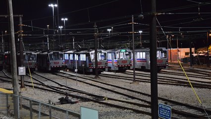
RTA maintenance facility, which stores both light rail and heavy rail vehicles, adjacent to East 55th Street station. We saw a number of different employees walk from the station to the maintenance facility.
A Red Line train departs East 55th Street on its way to Windmere.
A Green Line train arrives at East 55th Street on its way towards Tower City. And yes, these stations have music piped in from WHLK, a local radio station.
A Green Line train services East 55th Street station.
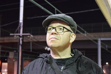
Elyse took my DSLR for a moment and got a photo of me standing on the platform.
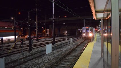
Our Red Line train arrives to take us back to Tower City Center.
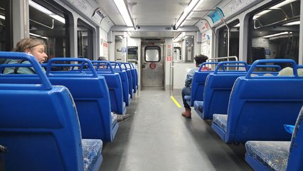
Interior of railcar 199, manufactured by Tokyu.
Our train prepares to depart Tower City Center.
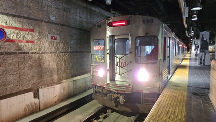
Our Red Line train departs Tower City Center on its way to the airport.
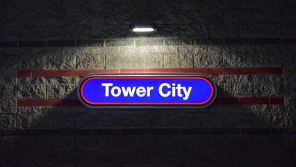
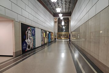
Lighted wall signage at Tower City Center.
We would have ridden more, but our time in Cleveland was up if we were to have any chance of getting home that evening. That was fine, because Cleveland RTA wasn’t going anywhere, and we had already decided that we wanted to do another visit to Cleveland in the future as its own thing. We did, however, briefly explore around Tower City before parting company with Clay.
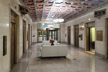
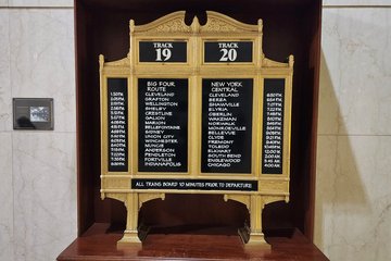
Various locations around Tower City.
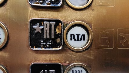
Elevator button to take you down to RTA, with their logo, which I feel strongly resembles the RCA logo, on the button itself.
On the way out, we ended up following Clay’s car for some distance, mainly because we were all going the same way. Elyse and Kyle had noted that Clay had driven in a somewhat fast and furious manner when they were riding with him, and they suspected that he had been showing off for them in his Tesla. We never mentioned where we were going afterward, and our following him was not planned. It just worked out that way. But we stayed behind him at varying distances, and observed, never making our presence known, and figuring that he probably hadn’t seen us or paid any attention to us. We soon figured out that Clay was a good driver under more normal conditions, and he didn’t drive like a stereotypical teenaged boy when he didn’t have anyone to show off to. Good. We parted company for good when our routes diverged, and we went on our way while he went on his, and that was that.
Our last stop for a while was the Culver’s in Macedonia. This was intentional, as we wanted to make one final stop at a Culver’s before leaving their market area. Culver’s is mostly a Midwestern chain, though they have expanded into other regions, but they have no locations within a reasonable distance of the Washington, DC area. The nearest Culver’s locations to us are in Wake Forest and Wilson, North Carolina, both about four hours’ driving time from my house.
My meal at Culver’s consisted of a burger and some of their cheese curds, along with four little cups of ketchup.
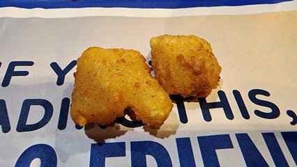
I noticed these two cheese curds next to each other, and the first thing that came to my mind that they looked like the 1980s-era TVOntario logo.
Leaving Culver’s, we began the final slog back home. We got back on I-80, which was the Ohio Turnpike at that point, and then continued onto I-76 as I-80 left the turnpike and the turnpike continued as I-76. We continued that into Pennsylvania, where it became the Pennsylvania Turnpike. This was a very long and boring stretch of road, and we were again having the same arguments as before about conversation vs. podcasts, as I did my best to remain engaged while driving through long, dark stretches of rural road with nothing to really look at.
In an effort to keep things more interesting, i.e. have things to look at, rather than skirt Pittsburgh to the north as the turnpike would have us do, we opted to get off of the turnpike in Big Beaver (stop laughing) to take I-376 through Pittsburgh, and then rejoin the turnpike east of the city. It only added fifteen minutes, and that would give us more to look at and discuss. We also picked up some local radio stations while we were driving through. I couldn’t tell you what station we were listening to, or if what we were listening to was local in origin or a syndicated program, but at least we had something going on the radio. We didn’t mind going through Pittsburgh, plus this was all new for Kyle, as he had never been to Pittsburgh before. We never left the freeway the entire time, but all the same, we did see Pittsburgh, even if only for a few moments. Considering how poorly we had managed our pacing for this trip, it was definitely a good thing that we did Pittsburgh as a separate trip earlier in the year, because we definitely would have gone over our allotted time there. We then rejoined the turnpike at the Monroeville interchange, and kept things moving.
We had planned a stop somewhere on the turnpike between Pittsburgh and Breezewood, but while I had planned to make it at the South Somerset service plaza, a restroom need from Elyse moved that up a bit, necessitating getting off of the turnpike at North Huntingdon and going to a Sheetz. There, I filled the car up again, and we went in to get drinks and take care of restroom needs. Inside, we found a mother and daughter who had recently been in a pretty bad car accident while traveling, and were waiting at the Sheetz while they determined their plans. That had to be an awful way to end a trip, losing your car and all. Hopefully they were able to get home okay.
Finishing up at Sheetz, we resumed, now back in familiar territory as we navigated the Pennsylvania Turnpike to Breezewood. This part of the trip was probably our lowest as far as interpersonal relations went, as Elyse had become quite tired of my attempts to keep us on schedule, and, failing that, to keep myself engaged on these long, dark stretches of road through rural areas. She argued that keeping me engaged wasn’t her problem when she wanted quiet, but I argued that it would her problem if I fell asleep at the wheel from the long hours and lack of mental stimulation. I’m pretty sure that we all said some things that we wished that we hadn’t during that part of the trip.
At Breezewood, we stopped at the Sheetz again, and I went in so that I could get a respite from everyone else for a little while. According to my Google timeline, we were there for about 30 minutes. Honestly, I needed time to just cool down for a while before continuing. I did the Wordle for the day, I checked my Facebook, I looked at Reddit, and so on.
Returning to the car, we did the final 97 miles home. Elyse and Kyle sat more or less in silence, while I listened to various podcast episodes to stay engaged for the remainder of the trip. All in all, despite our terrible pacing while on the road that put me into some very undesirable driving situations, I’d say that we had a pretty good trip, despite a notable equipment failure and resultant loss of photographic content in Sheboygan. We managed to make the ride out and back a part of the trip rather than merely a task to be completed before getting to the fun parts, and we found quite a few places that we would love to explore in more detail on their own adventures in the future.
